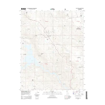
2015 Map of Coulterville
USGS Topo · Published 2015About this map
Coulterville stands as a focal point in this 2015 study of Mariposa County, where the transition from the Stanislaus National Forest to the waters of Lake McClure creates a landscape of steep gulches and high points. The map provides a detailed look at the local road network connecting historic settlements, such as the route along Mary Harrison Mine Rd and the path to Dogtown. To the north, Greeley Hill and Peñon Blanco Point overlook a terrain carved by Blacks Cr and Maxwell Cr. The southern portion is defined by the Hunter Valley region, bordered by Hunter Valley Mtn and several notable gulches including David Gulch and Scotch Gulch. This survey captures the modern footprint of these Sierra Nevada foothills, documenting the persistent naming conventions and land divisions of the Public Land Survey System including t2s r16e and t2s r17e.
Find a feature on this map
55 named features on this map. Tap any name to fly to it.
Don’t see what you’re looking for? This feature index may not catch every label — zoom into the map to look around manually.
Map Details
Editions of this 2015 Coulterville Map
This is the sole edition of this map. No revisions or reprints were ever made.
Other maps of this area

1893 · Sonora
USGS Topo · 1:125,000

1896 · Sonora
USGS Topo · 1:125,000

1897 · Sonora
USGS Topo · 1:125,000

1898 · Sonora
USGS Topo · 1:125,000

1916 · Merced Falls
USGS Topo · 1:24,000

1919 · Merced Falls
USGS Topo · 1:31,680

1944 · Merced Falls
USGS Topo · 1:62,500

1947 · San Jose
USGS Topo · 1:250,000

1947 · Coulterville
USGS Topo · 1:62,500
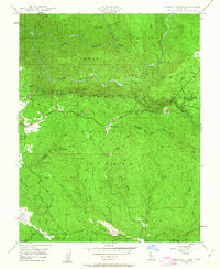
1947 · Jawbone Ridge
USGS Topo · 1:24,000