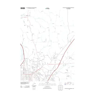
2013 Map of Council Bluffs North
USGS Topo · Published 2013About this map
Crescent and Chautauqua anchor the northern reaches of this Missouri River valley landscape, where the bluffs transition into a complex network of drainage and transport. The historical importance of the region's infrastructure is evident in the presence of the Old Lincoln Hwy and the Morman Bridge Rd, routes that shaped the early 20th-century movement through Pottawattamie County. In the southern portion of the quadrangle, the institutional presence of Iowa Western Community College and the Council Bluffs Municipal Airport reflect the modern development and educational footprint of the area north of the city center. Water management is a defining feature of the terrain, with natural courses like Mosquito Cr and Little Mosquito Cr flowing near modified structures such as the Indian Cr-Ditch, illustrating the ongoing engineering of the watershed to support the expanding suburban and industrial requirements of the Iowa-Nebraska borderlands.
Find a feature on this map
209 named features on this map. Tap any name to fly to it.
Don’t see what you’re looking for? This feature index may not catch every label — zoom into the map to look around manually.
Map Details
Editions of this 2013 Council Bluffs North Map
This is the sole edition of this map. No revisions or reprints were ever made.
Other maps of this area

1893 · Omaha
USGS Topo · 1:62,500

1954 · Omaha
USGS Topo · 1:250,000

1956 · Underwood
USGS Topo · 1:24,000

1956 · Mineola
USGS Topo · 1:24,000

1956 · Council Bluffs North
USGS Topo · 1:24,000

1956 · Omaha North
USGS Topo · 1:24,000

1956 · Mc Clelland
USGS Topo · 1:24,000

1956 · Council Bluffs South
USGS Topo · 1:24,000

1956 · Omaha South
USGS Topo · 1:24,000

1957 · Omaha
USGS Topo · 1:250,000