
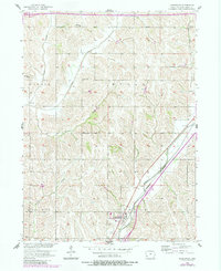
1956 Map of Underwood
USGS Topo · Published 1956About this map
The settlement of Underwood serves as the focal point of this mid-century survey of Pottawattamie County, situated at the intersection of the Chicago Milwaukee ST Paul And Pacific and the C & GW rail lines. The landscape is defined by the winding paths of several waterways, most notably Mosquito Creek and Pigeon Creek, which cut through the agricultural townships of Boomer, Neola, Hazel Dell, and Norwalk. A dense network of local education is evident, with numerous rural schoolhouses such as Beehive Sch, Porter Sch, and Spencer Sch distributed across the sections. Genealogists will find particular value in the locations of Castor Cem and Fisher Cem, preserved here alongside the family-named landmarks and creeks that shaped the county's early development and rural community structure.
Find a feature on this map
22 named features on this map. Tap any name to fly to it.
Don’t see what you’re looking for? This feature index may not catch every label — zoom into the map to look around manually.
Map Details
Editions of this 1956 Underwood Map
2 editions found
Other maps of this area

1893 · Omaha
USGS Topo · 1:62,500

1954 · Omaha
USGS Topo · 1:250,000

1956 · Council Bluffs North
USGS Topo · 1:24,000

1956 · Neola
USGS Topo · 1:24,000

1956 · Mc Clelland
USGS Topo · 1:24,000

1957 · Omaha
USGS Topo · 1:250,000

1957 · Taylor
USGS Topo · 1:24,000

1957 · Honey Creek
USGS Topo · 1:24,000

1958 · Omaha
USGS Topo · 1:250,000
1970 · Beebeetown
USGS Topo · 1:24,000