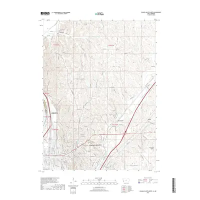
2018 Map of Council Bluffs North
USGS Topo · Published 2018About this map
Council Bluffs and the eastern edge of Omaha define the urban character of this recent survey, where the Missouri River serves as the state boundary between Iowa and Nebraska. The landscape transitions from the dense street grids of the city to the loess hills of Pottawattamie County, marked by a high concentration of burial sites including Saint Joseph Cem, Walnut Hill Cem, and the rural Hazel Dell Cem to the northeast. Transportation corridors are prominent, with Railroad Hwy and the winding Lewis and Clark Monument Trail providing access to the higher elevations overlooking the river valley. Smaller rural clusters like Crescent and Chautauqua remain distinct from the primary urban centers, while the Council Bluffs Municipal Airport sits on the eastern plain near Little Mosquito Cr.
Find a feature on this map
197 named features on this map. Tap any name to fly to it.
Don’t see what you’re looking for? This feature index may not catch every label — zoom into the map to look around manually.
Map Details
Editions of this 2018 Council Bluffs North Map
This is the sole edition of this map. No revisions or reprints were ever made.
Other maps of this area

1893 · Omaha
USGS Topo · 1:62,500

1954 · Omaha
USGS Topo · 1:250,000

1956 · Underwood
USGS Topo · 1:24,000

1956 · Mineola
USGS Topo · 1:24,000

1956 · Council Bluffs North
USGS Topo · 1:24,000

1956 · Omaha North
USGS Topo · 1:24,000

1956 · Mc Clelland
USGS Topo · 1:24,000

1956 · Council Bluffs South
USGS Topo · 1:24,000

1956 · Omaha South
USGS Topo · 1:24,000

1957 · Omaha
USGS Topo · 1:250,000