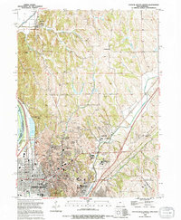
1994 Map of Council Bluffs North
USGS Topo · Published 1994About this map
The Missouri River corridor north of Council Bluffs reveals a complex landscape of flood control and suburban expansion in the early 1990s. While the southern portion of the sheet is densely organized with city landmarks like the Library, City Hall, and numerous schools such as Wilson Jr High Sch and Bloomer Sch, the northern reaches transition into a more rural pattern. Here, family and community history is preserved in sites like Hazel Dell Ch Cem and Evans Cem, while the industrial footprint of the Chicago and North Western rail line skirts the bluff line.
Find a feature on this map
59 named features on this map. Tap any name to fly to it.
Don’t see what you’re looking for? This feature index may not catch every label — zoom into the map to look around manually.
Map Details
Editions of this 1994 Council Bluffs North Map
This is the sole edition of this map. No revisions or reprints were ever made.
Other maps of this area

1893 · Omaha
USGS Topo · 1:62,500

1954 · Omaha
USGS Topo · 1:250,000

1956 · Underwood
USGS Topo · 1:24,000

1956 · Mineola
USGS Topo · 1:24,000

1956 · Council Bluffs North
USGS Topo · 1:24,000

1956 · Omaha North
USGS Topo · 1:24,000

1956 · Mc Clelland
USGS Topo · 1:24,000

1956 · Council Bluffs South
USGS Topo · 1:24,000

1956 · Omaha South
USGS Topo · 1:24,000

1957 · Omaha
USGS Topo · 1:250,000