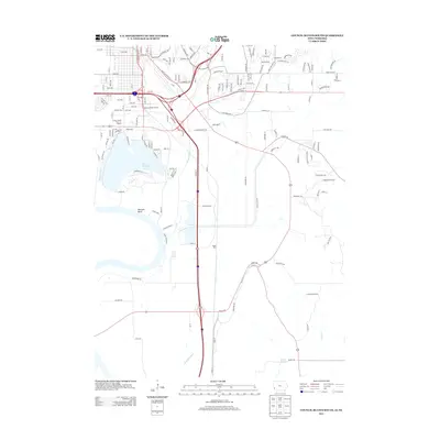
2013 Map of Council Bluffs South
USGS Topo · Published 2013About this map
Lake Manawa and its surrounding floodplains dominate this 2013 portrait of the southern reaches of Council Bluffs. The landscape is defined by the heavy management of Missouri River tributaries, featuring complex water engineering such as the Indian Cr Ditch, Saint Marys Ditch, and the winding course of Mosquito Cr. The area around Manawa Bend shows a mixture of industrial and commercial development, most notably the Manawa Power Centre, alongside recreational and cultural landmarks like the Council Bluffs Drive-In-Theatre.
Find a feature on this map
159 named features on this map. Tap any name to fly to it.
Don’t see what you’re looking for? This feature index may not catch every label — zoom into the map to look around manually.
Map Details
Editions of this 2013 Council Bluffs South Map
This is the sole edition of this map. No revisions or reprints were ever made.
Other maps of this area

1893 · Omaha
USGS Topo · 1:62,500

1954 · Omaha
USGS Topo · 1:250,000

1956 · Glenwood
USGS Topo · 1:24,000

1956 · Mineola
USGS Topo · 1:24,000

1956 · Plattsmouth
USGS Topo · 1:24,000

1956 · Council Bluffs North
USGS Topo · 1:24,000

1956 · Pacific Junction
USGS Topo · 1:24,000

1956 · Omaha North
USGS Topo · 1:24,000

1956 · Mc Clelland
USGS Topo · 1:24,000

1956 · Council Bluffs South
USGS Topo · 1:24,000