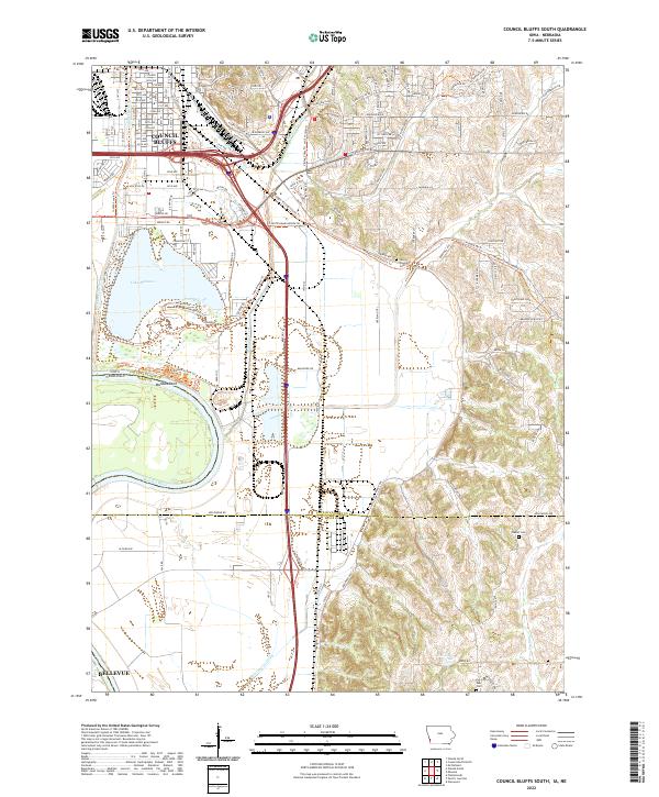
2022 Map of Council Bluffs South
USGS Topo · Published 2022About this map
Council Bluffs occupies the northern reaches of this landscape, where the urban grid gives way to the complex hydrology of the Missouri River floodplain. The southern outskirts are defined by Lake Manawa, a prominent oxbow lake that anchors local recreation. To the east, the terrain rises into the characteristic bluffs, dissected by Mosquito Creek and Indian Cr Ditch. This geography creates a sharp contrast between the dense residential avenues of the city, such as 24th Ave and Wright Rd, and the agricultural lowlands to the south near Bellevue. Genealogists and local historians can locate several burial sites along the eastern ridges, including Lewis Township Cem, Plumer Cem, and Saar Cem. The institutional presence of the Iowa School for Deaf remains a significant landmark within the transition from city to countryside.
Find a feature on this map
51 named features on this map. Tap any name to fly to it.
Don’t see what you’re looking for? This feature index may not catch every label — zoom into the map to look around manually.
Map Details
Editions of this 2022 Council Bluffs South Map
This is the sole edition of this map. No revisions or reprints were ever made.
Other maps of this area

1893 · Omaha
USGS Topo · 1:62,500

1954 · Omaha
USGS Topo · 1:250,000

1956 · Glenwood
USGS Topo · 1:24,000

1956 · Mineola
USGS Topo · 1:24,000

1956 · Plattsmouth
USGS Topo · 1:24,000

1956 · Council Bluffs North
USGS Topo · 1:24,000

1956 · Pacific Junction
USGS Topo · 1:24,000

1956 · Omaha North
USGS Topo · 1:24,000

1956 · Mc Clelland
USGS Topo · 1:24,000

1956 · Council Bluffs South
USGS Topo · 1:24,000