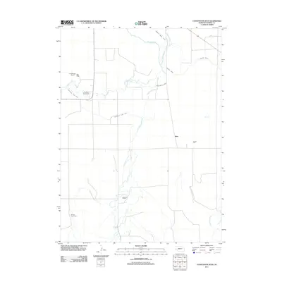
2011 Map of Courthouse Rock
USGS Topo · Published 2011About this map
Courthouse Rock and Jail Rock rise above the Nebraska plains, serving as iconic landmarks in this western Morrill County landscape. These distinctive formations are complemented by the Courthouse and Jail Rock Golf Course, illustrating the modern recreational use of this storied terrain. The area's agricultural reliance on water is evidenced by a complex network of irrigation infrastructure, including the Belmont Canal, Courthouse Rock Canal, and the Last Chance Canal, all fed by the winding course of Pumpkin Creek.
Find a feature on this map
15 named features on this map. Tap any name to fly to it.
Don’t see what you’re looking for? This feature index may not catch every label — zoom into the map to look around manually.
Map Details
Editions of this 2011 Courthouse Rock Map
This is the sole edition of this map. No revisions or reprints were ever made.
Other maps of this area

1896 · Browns Creek
USGS Topo · 1:125,000

1898 · Camp Clarke
USGS Topo · 1:125,000

1899 · Browns Creek
USGS Topo · 1:125,000

1899 · Sidney
USGS Topo · 1:125,000

1954 · Scottsbluff
USGS Topo · 1:250,000

1958 · Scottsbluff
USGS Topo · 1:250,000

1965 · Bridgeport NW
USGS Topo · 1:24,000

1965 · Courthouse Rock
USGS Topo · 1:24,000

1965 · Broadwater NW
USGS Topo · 1:24,000
1965 · Bridgeport
USGS Topo · 1:24,000