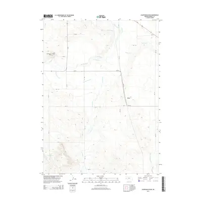
2014 Map of Courthouse Rock
USGS Topo · Published 2014About this map
Courthouse Rock and Jail Rock rise above the Platte River Valley landscape, serving as prominent geological landmarks in this portion of Morrill County. The 2014 terrain is defined by an intricate network of irrigation infrastructure essential to high-plains agriculture, including the Belmont Canal, Courthouse Rock Canal, and the Last Chance Canal. These man-made waterways divert from local sources like Pumpkin Cr and Greenwood Cr to sustain the surrounding fields. Near the intersection of Road 78 and Road 105 lies the small community of Alden, representing the local settlement pattern of the era. The presence of the Harless-Ogard Reservoir and the uniquely named Deep Holes further illustrates the critical role of water management in this environment. Modern transportation is facilitated by Ne 88 and Us-385, which cut through the gridded county road system that organizes the rural acreage.
Find a feature on this map
27 named features on this map. Tap any name to fly to it.
Don’t see what you’re looking for? This feature index may not catch every label — zoom into the map to look around manually.
Map Details
Editions of this 2014 Courthouse Rock Map
This is the sole edition of this map. No revisions or reprints were ever made.
Other maps of this area

1896 · Browns Creek
USGS Topo · 1:125,000

1898 · Camp Clarke
USGS Topo · 1:125,000

1899 · Browns Creek
USGS Topo · 1:125,000

1899 · Sidney
USGS Topo · 1:125,000

1954 · Scottsbluff
USGS Topo · 1:250,000

1958 · Scottsbluff
USGS Topo · 1:250,000

1965 · Bridgeport NW
USGS Topo · 1:24,000

1965 · Courthouse Rock
USGS Topo · 1:24,000

1965 · Broadwater NW
USGS Topo · 1:24,000
1965 · Bridgeport
USGS Topo · 1:24,000