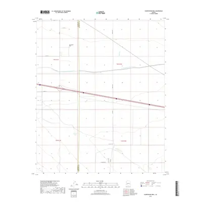
2018 Map of Courthouse Well
USGS Topo · Published 2018About this map
The Harquahala Plain dominates this arid landscape, bisected by the massive engineering works of the Central Arizona Project Aqueduct. This section of the desert floor, located near the La Paz and Maricopa County border, reveals a network of rural routes such as Aguila Rd and Eagle Eye Rd that provide access to isolated water sources. Significant landmarks for local travelers and ranchers include Courthouse Well and Eagletail Tank, which serve as vital points of interest in a region primarily shaped by wide ephemeral drainages like Tiger Wash. The map illustrates the 21st-century infrastructure of the American Southwest, where modern water management systems and interstate corridors cross through traditional desert reaches defined by section lines and remote roadway extensions like W Camelback Rd.
Find a feature on this map
19 named features on this map. Tap any name to fly to it.
Don’t see what you’re looking for? This feature index may not catch every label — zoom into the map to look around manually.
Map Details
Editions of this 2018 Courthouse Well Map
This is the sole edition of this map. No revisions or reprints were ever made.
Other maps of this area

1942 · Vicksburg
USGS Topo · 1:250,000

1954 · Phoenix
USGS Topo · 1:250,000

1957 · Phoenix
USGS Topo · 1:250,000

1958 · Phoenix
USGS Topo · 1:250,000

1960 · Phoenix
USGS Topo · 1:250,000

1961 · Lone Mountain
USGS Topo · 1:62,500

1961 · Big Horn Mts
USGS Topo · 1:62,500

1962 · Cortez Peak
USGS Topo · 1:62,500

1962 · Eagletail Mts
USGS Topo · 1:62,500

1969 · Phoenix
USGS Topo · 1:250,000