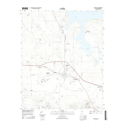
2014 Map of Courtland
USGS Topo · Published 2014About this map
Courtland and North Courtland occupy a central position in this Lawrence County landscape, framed by the meandering path of Big Nance Creek as it flows toward Wheeler Lake and the Tennessee River. The area is densely marked with family and community cemeteries, including Houston Cem, Sherrod Cem, and the Andrew Garth Memorial Cem, providing a significant record of local lineage. The layout of the town is defined by historic corridors like Jefferson St and Al-20, while the nearby Courtland Airport and its surrounding aviation-themed streets—Lindbergh St, Cessna Ave, and Sanderson Ln—highlight the mid-century infrastructure of the region. To the south, the topography rises toward Mackeys Mtn and Dedicar Mtn, contrasting with the numerous spring-fed ponds and branches like Swoope Pond and Sandy Br that dot the lowland basin.
Find a feature on this map
97 named features on this map. Tap any name to fly to it.
Don’t see what you’re looking for? This feature index may not catch every label — zoom into the map to look around manually.
Map Details
Editions of this 2014 Courtland Map
This is the sole edition of this map. No revisions or reprints were ever made.
Other maps of this area

1914 · Rogersville
USGS Topo · 1:48,000

1916 · Rogersville
USGS Topo · 1:62,500

1936 · Caddo
USGS Topo · 1:24,000

1936 · Thorntontown
USGS Topo · 1:24,000

1936 · Courtland
USGS Topo · 1:24,000

1936 · Hillsboro
USGS Topo · 1:24,000

1936 · Wheeler Dam
USGS Topo · 1:24,000

1936 · Town Creek
USGS Topo · 1:24,000

1936 · Cairo
USGS Topo · 1:24,000

1936 · Masterson
USGS Topo · 1:24,000