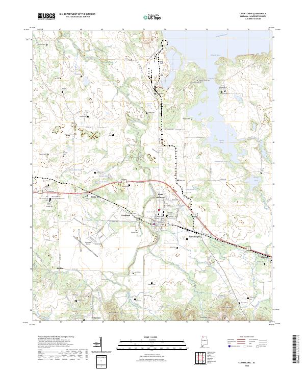
2024 Map of Courtland
USGS Topo · Published 2024About this map
Big Nance Creek winds northward through this Lawrence County landscape, passing the established settlements of Courtland and North Courtland. The 2024 data highlights a complex network of county roads and family-named cemeteries that speak to the deep genealogical roots of the Tennessee Valley, such as the Andrew Garth Memorial Cem near the shores of Wheeler Lake. This map captures the modern layout of the Courtland Airport and the heavy industrial presence near Lockheed Martin Way.
Find a feature on this map
115 named features on this map. Tap any name to fly to it.
Don’t see what you’re looking for? This feature index may not catch every label — zoom into the map to look around manually.
Map Details
Editions of this 2024 Courtland Map
This is the sole edition of this map. No revisions or reprints were ever made.
Other maps of this area

1914 · Rogersville
USGS Topo · 1:48,000

1916 · Rogersville
USGS Topo · 1:62,500

1936 · Caddo
USGS Topo · 1:24,000

1936 · Thorntontown
USGS Topo · 1:24,000

1936 · Courtland
USGS Topo · 1:24,000

1936 · Hillsboro
USGS Topo · 1:24,000

1936 · Wheeler Dam
USGS Topo · 1:24,000

1936 · Town Creek
USGS Topo · 1:24,000

1936 · Cairo
USGS Topo · 1:24,000

1936 · Masterson
USGS Topo · 1:24,000