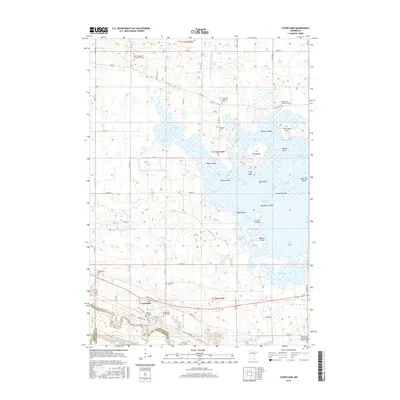
2016 Map of Courtland
USGS Topo · Published 2016About this map
Swan Lake dominates this landscape in southern Minnesota, its complex shoreline defined by numerous bays and points such as Larson Bay, Poor Farm Bay, and Hackberry Point. The intricate hydrology of the area is managed through systems like County Ditch Number Thirtyeight, while the Minnesota River forms a natural southern boundary near the settlement of Courtland. This mapping reveals a high density of small family and community burial grounds, reflecting the deep agricultural roots of Nicollet County. Genealogists will find many specific sites of interest, including the Fechner Farm Cem and Zimmerman Private Cem, as well as several denominational anchors like Zion Evangelical Lutheran Church. The varied terrain includes significant landforms within the lake itself, most notably Monson Island and Big Island, which break up the expansive water of South Bay and Pellings Bay.
Find a feature on this map
69 named features on this map. Tap any name to fly to it.
Don’t see what you’re looking for? This feature index may not catch every label — zoom into the map to look around manually.
Map Details
Editions of this 2016 Courtland Map
This is the sole edition of this map. No revisions or reprints were ever made.
Other maps of this area

1951 · Mankato West
USGS Topo · 1:62,500

1953 · New Ulm
USGS Topo · 1:250,000

1957 · New Ulm
USGS Topo · 1:250,000

1958 · New Ulm
USGS Topo · 1:250,000

1964 · Bernadotte
USGS Topo · 1:24,000

1964 · New Ulm
USGS Topo · 1:24,000

1964 · Courtland
USGS Topo · 1:24,000

1964 · Lafayette
USGS Topo · 1:24,000

1965 · Hanska
USGS Topo · 1:24,000

1965 · New Sweden
USGS Topo · 1:24,000