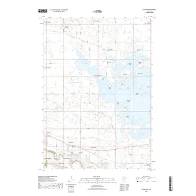
2019 Map of Courtland
USGS Topo · Published 2019About this map
Swan Lake dominates the northern half of this Nicollet County landscape, its complex shoreline defined by numerous bays and points such as Larson Bay and Poor Farm Point. This massive water body is drained to the south via the Swan Lake Outlet, which eventually meets the Minnesota River as it winds along the southern border of the map. The village of Courtland is situated on the terrace above the river valley, serving as a hub for the surrounding agricultural township sections.
Find a feature on this map
69 named features on this map. Tap any name to fly to it.
Don’t see what you’re looking for? This feature index may not catch every label — zoom into the map to look around manually.
Map Details
Editions of this 2019 Courtland Map
This is the sole edition of this map. No revisions or reprints were ever made.
Other maps of this area

1951 · Mankato West
USGS Topo · 1:62,500

1953 · New Ulm
USGS Topo · 1:250,000

1957 · New Ulm
USGS Topo · 1:250,000

1958 · New Ulm
USGS Topo · 1:250,000

1964 · Bernadotte
USGS Topo · 1:24,000

1964 · New Ulm
USGS Topo · 1:24,000

1964 · Courtland
USGS Topo · 1:24,000

1964 · Lafayette
USGS Topo · 1:24,000

1965 · Hanska
USGS Topo · 1:24,000

1965 · New Sweden
USGS Topo · 1:24,000