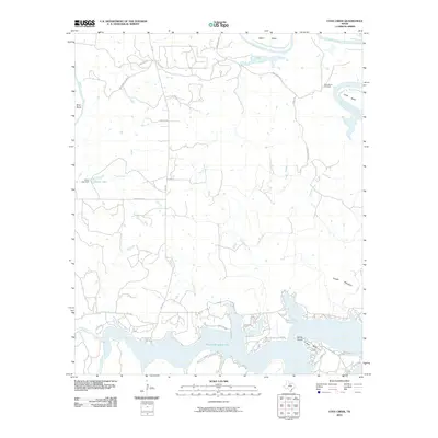
2010 Map of Cove Creek
USGS Topo · Published 2010About this map
Possum Kingdom Lake dominates the southern landscape of this Palo Pinto County region, with the protected acreage of Possum Kingdom State Park lining its northern shores. The shoreline is characterized by distinctive points and inlets, including the shoreline settlement of Sandy Beach and the sweeping curve of Poor Bend. To the north, the Brazos River meanders through the terrain in a series of dramatic oxbows, creating isolated pockets of land such as Salem Bend, Brier Bend, and Long Bend.
Find a feature on this map
33 named features on this map. Tap any name to fly to it.
Don’t see what you’re looking for? This feature index may not catch every label — zoom into the map to look around manually.
Map Details
Editions of this 2010 Cove Creek Map
This is the sole edition of this map. No revisions or reprints were ever made.
Other maps of this area

1890 · Breckenridge
USGS Topo · 1:125,000

1891 · Palo Pinto
USGS Topo · 1:125,000

1918 · Palo Pinto
USGS Topo · 1:125,000

1924 · Breckenridge 1-a
USGS Topo · 1:48,000

1924 · Palo Pinto 2-b
USGS Topo · 1:48,000

1924 · Graham 4-d
USGS Topo · 1:48,000

1924 · Palo Pinto 2-c
USGS Topo · 1:48,000

1924 · Breckenridge 1-d
USGS Topo · 1:48,000

1925 · Graham 4-c
USGS Topo · 1:48,000

1925 · Breckenridge 1-b
USGS Topo · 1:48,000