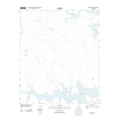
2012 Map of Cove Creek
USGS Topo · Published 2012About this map
Possum Kingdom Lake dominates the southern landscape of this Palo Pinto County quadrangle, where the reservoir's complex shoreline creates prominent features like Sandy Beach and Poor Bend. To the north, the Brazos River carves deep loops through the terrain at Salem Bend and Long Bend, reflecting a landscape defined by significant water management and natural drainage systems. Several major creeks, including Cove Cr, Maloney Cr, and Fox Hollow Cr, flow southward toward the lake, intersecting a network of rural routes such as FM-1148 and Chapel Rd. Local history is anchored by the Ming Bend Cem near the river's edge and the settlement of Lindley north of the lake. The elevation rises toward the southeast at Caudill Mtn, overlooking the many inlets and coves that have reshaped this portion of North Central Texas.
Find a feature on this map
50 named features on this map. Tap any name to fly to it.
Don’t see what you’re looking for? This feature index may not catch every label — zoom into the map to look around manually.
Map Details
Editions of this 2012 Cove Creek Map
This is the sole edition of this map. No revisions or reprints were ever made.
Other maps of this area

1890 · Breckenridge
USGS Topo · 1:125,000

1891 · Palo Pinto
USGS Topo · 1:125,000

1918 · Palo Pinto
USGS Topo · 1:125,000

1924 · Breckenridge 1-a
USGS Topo · 1:48,000

1924 · Palo Pinto 2-b
USGS Topo · 1:48,000

1924 · Graham 4-d
USGS Topo · 1:48,000

1924 · Palo Pinto 2-c
USGS Topo · 1:48,000

1924 · Breckenridge 1-d
USGS Topo · 1:48,000

1925 · Graham 4-c
USGS Topo · 1:48,000

1925 · Breckenridge 1-b
USGS Topo · 1:48,000