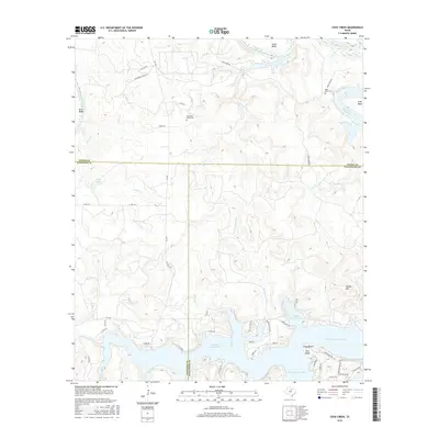
2016 Map of Cove Creek
USGS Topo · Published 2016About this map
The Brazos River snakes through the Texas landscape here, carving dramatic horseshoe loops like Salem Bend and Long Bend before entering the northern reaches of Possum Kingdom Lake. This transition from riverine canyon to reservoir defines the local geography, where the Broadway Channel provides deep-water access near the Sandy Beach settlement. Higher elevations are marked by landmarks like Caudill Mtn, while the plateau is dotted with sites of genealogical interest such as Mountain Home Cem and Ming Bend Cem. The map reveals a rural network of ranching and recreation, indicated by the Whitenburg Ranch and numerous county roads and farm-to-market routes that intersect the boundaries of Young, Stephens, and Palo Pinto counties.
Find a feature on this map
52 named features on this map. Tap any name to fly to it.
Don’t see what you’re looking for? This feature index may not catch every label — zoom into the map to look around manually.
Map Details
Editions of this 2016 Cove Creek Map
This is the sole edition of this map. No revisions or reprints were ever made.
Other maps of this area

1890 · Breckenridge
USGS Topo · 1:125,000

1891 · Palo Pinto
USGS Topo · 1:125,000

1918 · Palo Pinto
USGS Topo · 1:125,000

1924 · Breckenridge 1-a
USGS Topo · 1:48,000

1924 · Palo Pinto 2-b
USGS Topo · 1:48,000

1924 · Graham 4-d
USGS Topo · 1:48,000

1924 · Palo Pinto 2-c
USGS Topo · 1:48,000

1924 · Breckenridge 1-d
USGS Topo · 1:48,000

1925 · Graham 4-c
USGS Topo · 1:48,000

1925 · Breckenridge 1-b
USGS Topo · 1:48,000