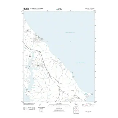
2011 Map of Cove Point
USGS Topo · Published 2011About this map
Chesapeake Bay shorelines and the tidal estuaries of the western shore define this coastal landscape. The central corridor is anchored by the community of Lusby, where the Lusby Post Office and nearby Middleham Cemetery mark the heart of local activity. To the south, the industrial presence of the Calvert Cliffs Nuclear Plant and the Columbia Lng Secondary Dam sit in contrast to the numerous residential coves and landings like Planters Wharf and White Sands.
Find a feature on this map
102 named features on this map. Tap any name to fly to it.
Don’t see what you’re looking for? This feature index may not catch every label — zoom into the map to look around manually.
Map Details
Editions of this 2011 Cove Point Map
This is the sole edition of this map. No revisions or reprints were ever made.
Other maps of this area

1892 · Leonardtown
USGS Topo · 1:62,500

1892 · Drum Point
USGS Topo · 1:62,500

1892 · Prince Frederick
USGS Topo · 1:62,500

1893 · Sharps Island
USGS Topo · 1:62,500

1895 · Prince Frederick
USGS Topo · 1:62,500

1895 · Leonardtown
USGS Topo · 1:62,500

1895 · Nomini
USGS Topo · 1:125,000

1898 · Choptank
USGS Topo · 1:125,000

1898 · Nomini
USGS Topo · 1:125,000

1898 · St. Marys
USGS Topo · 1:125,000