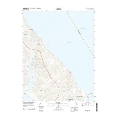
2014 Map of Cove Point
USGS Topo · Published 2014About this map
Cove Point and its adjacent shoreline define this coastal stretch of Calvert County along the Chesapeake Bay. The 2014 landscape shows a mix of established residential communities like Lusby, Calvert Beach, and the sprawling Chesapeake Ranch Estates, set against the dramatic natural relief of Calvert Cliffs and Nutts Cliffs. This era captures the developed road network following the ridge lines, primarily MD-2 and MD-765, which connect the inland settlements to the waterfront.
Find a feature on this map
41 named features on this map. Tap any name to fly to it.
Don’t see what you’re looking for? This feature index may not catch every label — zoom into the map to look around manually.
Map Details
Editions of this 2014 Cove Point Map
This is the sole edition of this map. No revisions or reprints were ever made.
Other maps of this area

1892 · Leonardtown
USGS Topo · 1:62,500

1892 · Drum Point
USGS Topo · 1:62,500

1892 · Prince Frederick
USGS Topo · 1:62,500
1893 · Sharps Island
USGS Topo · 1:62,500

1895 · Prince Frederick
USGS Topo · 1:62,500

1895 · Leonardtown
USGS Topo · 1:62,500

1895 · Nomini
USGS Topo · 1:125,000

1898 · Choptank
USGS Topo · 1:125,000

1898 · Nomini
USGS Topo · 1:125,000

1898 · St. Marys
USGS Topo · 1:125,000