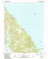
1987 Map of Cove Point
USGS Topo · Published 1987About this map
Cove Point and the surrounding Chesapeake shoreline are defined by a mix of established maritime heritage and late-20th-century industrial development. Along the eastern coast, the legendary Lighthouse stands as a landmark for navigation near Cove Point Marsh, while further north, the massive footprint of the Calvert Cliffs Nuclear Powerplant and the Liquefied Natural Gas Terminal signal the area's role in modern energy infrastructure. Inland, the landscape transitions from the preserved acreage of Calvert Cliffs State Park to the growing residential corridors around Lusby and Bertha.
Find a feature on this map
71 named features on this map. Tap any name to fly to it.
Don’t see what you’re looking for? This feature index may not catch every label — zoom into the map to look around manually.
Map Details
Editions of this 1987 Cove Point Map
This is the sole edition of this map. No revisions or reprints were ever made.
Other maps of this area

1892 · Leonardtown
USGS Topo · 1:62,500

1892 · Drum Point
USGS Topo · 1:62,500

1892 · Prince Frederick
USGS Topo · 1:62,500

1893 · Sharps Island
USGS Topo · 1:62,500

1895 · Prince Frederick
USGS Topo · 1:62,500

1895 · Leonardtown
USGS Topo · 1:62,500

1895 · Nomini
USGS Topo · 1:125,000

1898 · Choptank
USGS Topo · 1:125,000

1898 · Nomini
USGS Topo · 1:125,000

1898 · St. Marys
USGS Topo · 1:125,000