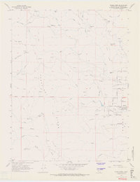
1967 Map of Covelo West
USGS Topo · Published 1969About this map
Round Valley dominates the eastern half of this landscape, where the settlement of Covelo serves as a central hub for the surrounding ranching and residential land. The map illustrates the structured layout of the valley floor, marked by distinct thoroughfares like Henderson Road and Foothill Blvd, alongside educational landmarks including Round Valley High School and the 7th Day Adventist School. This settled agricultural basin stands in sharp contrast to the high, ridged terrain to the west.
Find a feature on this map
57 named features on this map. Tap any name to fly to it.
Don’t see what you’re looking for? This feature index may not catch every label — zoom into the map to look around manually.
Map Details
Editions of this 1967 Covelo West Map
4 editions found
Other maps of this area

1920 · Covelo
USGS Topo · 1:62,500

1926 · Covelo
USGS Topo · 1:62,500

1929 · Eden Valley
USGS Topo · 1:62,500

1951 · Laytonville
USGS Topo · 1:62,500

1952 · Spyrock
USGS Topo · 1:62,500

1952 · Eden Valley
USGS Topo · 1:62,500

1952 · Covelo
USGS Topo · 1:62,500

1957 · Ukiah
USGS Topo · 1:250,000

1960 · Ukiah
USGS Topo · 1:250,000
1967 · Covelo West
USGS Topo · 1:24,000