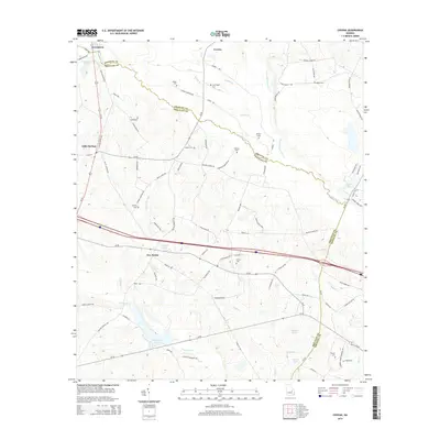
2014 Map of Covena
USGS Topo · Published 2014About this map
The Ohoopee River and its tributary, the Little Ohoopee River, wind through the borderlands of Emanuel and Treutlen Counties in this detailed 2014 survey. Small settlements like Norristown and Covena anchor the northern landscape, while Five Points marks a central crossroads near Courson Pond. The terrain is characterized by a dense network of water bodies, including Sumner Pond and Wildwood Lake, alongside many smaller branches such as Spring Br and Covena Br.
Find a feature on this map
87 named features on this map. Tap any name to fly to it.
Don’t see what you’re looking for? This feature index may not catch every label — zoom into the map to look around manually.
Map Details
Editions of this 2014 Covena Map
This is the sole edition of this map. No revisions or reprints were ever made.
Other maps of this area

1957 · Macon
USGS Topo · 1:250,000

1958 · Macon
USGS Topo · 1:250,000

1964 · Macon
USGS Topo · 1:250,000

1970 · Oak Park SW
USGS Topo · 1:24,000

1970 · Covena
USGS Topo · 1:24,000

1970 · Nunez
USGS Topo · 1:24,000

1970 · Oak Park
USGS Topo · 1:24,000

1971 · Norristown
USGS Topo · 1:24,000

1971 · Swainsboro
USGS Topo · 1:24,000

1971 · Soperton South
USGS Topo · 1:24,000