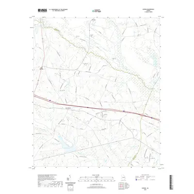
2020 Map of Covena
USGS Topo · Published 2020About this map
The Ohoopee River and Little Ohoopee River converge within this landscape, defining the boundary between Emanuel and Treutlen counties. Small rural settlements like Covena and Gillis Springs are connected by a network of winding roads, including Gillis Springs Rd and Holton Chapel Rd, which navigate the many river bends and swampy lowlands. Notable terrain features such as Horseshoe Bend and Ohoopee Bend emphasize the meandering nature of these waterways.
Find a feature on this map
83 named features on this map. Tap any name to fly to it.
Don’t see what you’re looking for? This feature index may not catch every label — zoom into the map to look around manually.
Map Details
Editions of this 2020 Covena Map
This is the sole edition of this map. No revisions or reprints were ever made.
Other maps of this area

1957 · Macon
USGS Topo · 1:250,000

1958 · Macon
USGS Topo · 1:250,000

1964 · Macon
USGS Topo · 1:250,000

1970 · Oak Park SW
USGS Topo · 1:24,000

1970 · Covena
USGS Topo · 1:24,000

1970 · Nunez
USGS Topo · 1:24,000

1970 · Oak Park
USGS Topo · 1:24,000

1971 · Norristown
USGS Topo · 1:24,000

1971 · Swainsboro
USGS Topo · 1:24,000

1971 · Soperton South
USGS Topo · 1:24,000