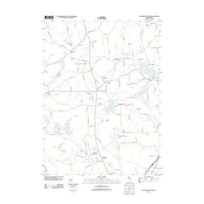
2012 Map of Coventry Center
USGS Topo · Published 2012About this map
Coventry and the surrounding rural townships in western Rhode Island are defined by a sprawling network of reservoirs and hills during this early 21st-century period. Large water bodies like the Flat River Reservoir and Quidnick Reservoir dominate the landscape, reflecting the region's long-standing water-management history. The terrain is marked by numerous family-named summits such as Bowen Hill, which features the Bowen Hill Lookout Tower, and Harkney Hill. Small, historic settlement nodes like Greene, Summit, and Potterville remain connected by winding routes like Old Plainfield Pike, while the southern portion of the map is home to the University of Rhode Island Alton Jones Campus in West Greenwich. This map provides a look at the transition between established villages and the densely wooded hills of the interior before further modern development.
Find a feature on this map
144 named features on this map. Tap any name to fly to it.
Don’t see what you’re looking for? This feature index may not catch every label — zoom into the map to look around manually.
Map Details
Editions of this 2012 Coventry Center Map
This is the sole edition of this map. No revisions or reprints were ever made.
Other maps of this area

1889 · Putnam
USGS Topo · 1:62,500

1889 · Burrillville
USGS Topo · 1:62,500

1889 · Moosup
USGS Topo · 1:62,500

1890 · Kent
USGS Topo · 1:62,500

1893 · Putnam
USGS Topo · 1:62,500

1893 · Moosup
USGS Topo · 1:62,500

1894 · Burrillville
USGS Topo · 1:62,500

1894 · Kent
USGS Topo · 1:62,500

1915 · Burrillville
USGS Topo · 1:62,500

1919 · Putnam
USGS Topo · 1:62,500