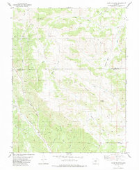
1983 Map of Cover Mountain
USGS Topo · Published 1983About this map
Cover Mountain dominates this landscape, rising above a complex network of canyons and drainages along the Park and Fremont county line. The terrain is deeply incised by dozens of named gulches, including Horsethief Gulch, Newberry Gulch, and Binckley Gulch, suggesting a territory defined by its challenging topography and reliable water sources like Currant Creek and Wilson Creek. Evidence of mineral exploration appears in the form of scattered prospects and localized mines, particularly in the western reaches near Mack Gulch. The prominent Cap Rock Ridge and Flat Top Ridge provide significant visual landmarks, while High Park Road serves as the primary corridor through this high-country environment. The survey reflects a sparsely populated area where the natural drainage patterns and geologic outcrops remain the most significant features of the land.
Find a feature on this map
26 named features on this map. Tap any name to fly to it.
Don’t see what you’re looking for? This feature index may not catch every label — zoom into the map to look around manually.
Map Details
Editions of this 1983 Cover Mountain Map
2 editions found
Other maps of this area

1894 · Pikes Peak
USGS Topo · 1:125,000

1901 · Pikes Peak
USGS Topo · 1:125,000

1942 · Cover Mtn.
USGS Topo · 1:62,500

1948 · Cover Mtn.
USGS Topo · 1:62,500

1954 · Pueblo
USGS Topo · 1:250,000

1957 · Pueblo
USGS Topo · 1:250,000

1958 · Pueblo
USGS Topo · 1:250,000

1959 · Black Mountain
USGS Topo · 1:62,500

1959 · Guffey
USGS Topo · 1:62,500
1959 · Florissant
USGS Topo · 1:62,500