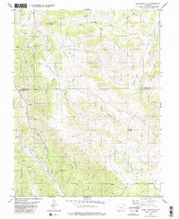
1983 Map of Cover Mountain
USGS Topo · Published 1983About this map
Cover Mountain dominates the high-elevation landscape of this 1983 survey, situated along the county boundary between Park and Fremont Counties. The terrain is defined by a complex network of drainages and dramatic geological features, including the prominent Cap Rock Ridge and its namesake Cap Rock. Waterways such as Currant Creek and Wilson Creek have carved deep paths through the high country, creating a rugged environment of ridges and basins like Flat Top Ridge and Beckham Basin. Evidence of early prospecting and extraction is scattered throughout the area, notably the Mines and various Prospect markings located west of Mack Gulch. These sites point to a history of mineral exploration in a region where travel followed the natural contours of gulches like Horsethief Gulch and Newberry Gulch.
Find a feature on this map
26 named features on this map. Tap any name to fly to it.
Don’t see what you’re looking for? This feature index may not catch every label — zoom into the map to look around manually.
Map Details
Editions of this 1983 Cover Mountain Map
2 editions found
Other maps of this area

1894 · Pikes Peak
USGS Topo · 1:125,000

1901 · Pikes Peak
USGS Topo · 1:125,000

1942 · Cover Mtn.
USGS Topo · 1:62,500

1948 · Cover Mtn.
USGS Topo · 1:62,500

1954 · Pueblo
USGS Topo · 1:250,000

1957 · Pueblo
USGS Topo · 1:250,000

1958 · Pueblo
USGS Topo · 1:250,000

1959 · Black Mountain
USGS Topo · 1:62,500

1959 · Guffey
USGS Topo · 1:62,500
1959 · Florissant
USGS Topo · 1:62,500