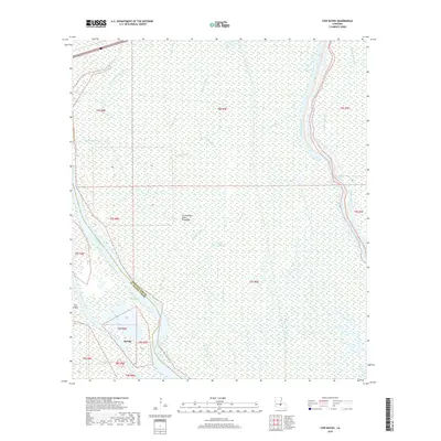
2018 Map of Cow Bayou
USGS Topo · Published 2018About this map
The Atchafalaya Basin Floodway dominates this part of southern Louisiana, defining a landscape shaped by water and intentional drainage. In the southwest, the small settlement of Rycade sits near the winding course of Bayou La Rompe and the Whisky Bay Pilot Channel. The terrain is a complex network of natural bayous and human-made cuts, such as the Blind Tensas Cut and Cow Island Cut-Off, designed to manage the flow of the basin.
Find a feature on this map
25 named features on this map. Tap any name to fly to it.
Don’t see what you’re looking for? This feature index may not catch every label — zoom into the map to look around manually.
Map Details
Editions of this 2018 Cow Bayou Map
This is the sole edition of this map. No revisions or reprints were ever made.
Other maps of this area

1935 · Osca Bayou
USGS Topo · 1:62,500

1935 · Chicot Lake
USGS Topo · 1:62,500

1940 · Grosse Tete
USGS Topo · 1:62,500

1941 · Loreauville
USGS Topo · 1:62,500

1953 · Cow Bayou
USGS Topo · 1:24,000

1953 · Pigeon Bay
USGS Topo · 1:24,000

1953 · Maringouin
USGS Topo · 1:24,000

1953 · Grosse Tete SW
USGS Topo · 1:24,000

1954 · Chicot Lake
USGS Topo · 1:62,500

1954 · Loreauville
USGS Topo · 1:62,500