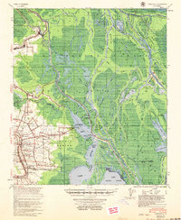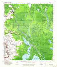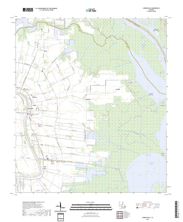
1941 Map of Loreauville
USGS Topo · Published 1943About this map
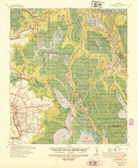
The low-lying wetlands of the Atchafalaya Basin define this landscape, where the Atchafalaya River and Grand River wind through a complex network of waterways like Lake Mongoulois and Lake Fausse Pointe. Near the edge of the swamp, the settlement of Loreauville serves as a hub for the surrounding agricultural and industrial activity, including the Broussard Switch along the Southern Pacific railroad line. The map captures the distinct cultural geography of the region, featuring numerous community landmarks such as St John Ch & Cem, Mt Zion Ch & Cem No 2, and Belle Chasse & Cem. Elevated salt domes, specifically the Lake Mongoulois Dome and Fausse Pointe Dome, stand out as critical geological features in an otherwise alluvial environment. Small landings and settlements like Bayou Chene and Catahoula illustrate the era's reliance on both rail and water transport before the extensive modern levee systems altered the basin's hydrology.
Find a feature on this map
78 named features on this map. Tap any name to fly to it.
Don’t see what you’re looking for? This feature index may not catch every label — zoom into the map to look around manually.
Map Details
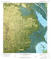
Editions of this 1941 Loreauville Map
This is the sole edition of this map. No revisions or reprints were ever made.
Historical Maps of Loreauville Through Time
9 maps found