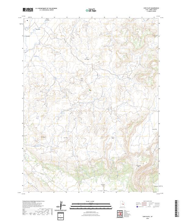
2023 Map of Cow Flats
USGS Topo · Published 2023About this map
Cow Flats and its surrounding plateau systems define this high-desert landscape in Emery County, Utah. The terrain is characterized by broad benches and flats, including Lemon Flats, Lucky Flats, and Wimmer Flat, which sit above the deeply etched drainages of Desert Seep Wash and Red Holes Wash. To the south, the elevation rises toward Cedar Mtn and the distinctively named The Nipple, overlooking Huff Bench. Water management in this arid environment is evident through several small-scale catchments such as Cow Flat Reservoir, Dugway Reservoir, and Little Blue Pond. These features, along with natural water sources like Ware Spring and Clay Seep, suggest a landscape shaped by the needs of range livestock and seasonal runoff management. The lack of significant road infrastructure, apart from Co RD 206 and Bull Hollow, underscores the area's primary use for open grazing and its isolation within the broader desert region.
Find a feature on this map
24 named features on this map. Tap any name to fly to it.
Don’t see what you’re looking for? This feature index may not catch every label — zoom into the map to look around manually.
Map Details
Editions of this 2023 Cow Flats Map
This is the sole edition of this map. No revisions or reprints were ever made.
Other maps of this area

1886 · Price River
USGS Topo · 1:250,000

1896 · Price River
USGS Topo · 1:250,000

1956 · Price
USGS Topo · 1:250,000

1960 · Price
USGS Topo · 1:250,000

1962 · Price
USGS Topo · 1:250,000

1969 · Olsen Reservoir
USGS Topo · 1:24,000
1969 · Chimney Rock
USGS Topo · 1:24,000
1969 · Bob Hill Knoll
USGS Topo · 1:24,000
1969 · Buckhorn Reservoir
USGS Topo · 1:24,000

1969 · Elmo
USGS Topo · 1:24,000