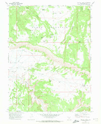
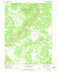
1969 Map of Bob Hill Knoll
USGS Topo · Published 1972About this map
Cedar Mountain dominates the northern reaches of this Emery County landscape, where the plateau gives way to the intricate drainage systems of the San Rafael Swell. The terrain is marked by a legacy of early ranching and transport, evidenced by family-named landmarks like Bob Hill Knoll and Joe Jensen Spring. A distinct Old Railroad Grade traverses the central expanse of Buckhorn Flat, reflecting late 19th-century industrial ambitions in this arid environment. To the south, the land drops into the dramatic geological formations of The Wedge, carved by Buckhorn Wash. Isolated features such as Buckhorn Corral and an unnamed Mine suggest a history of localized resource extraction and livestock management. This topographic study captures a transition from high mesa flats like Wimmer Flat to the deep incisions of Calf Canyon and Cow Canyon, mapping a territory defined more by its water sources—like Swazy Hole and Orsons Pond—than by permanent settlements.
Find a feature on this map
37 named features on this map. Tap any name to fly to it.
Don’t see what you’re looking for? This feature index may not catch every label — zoom into the map to look around manually.
Map Details
Editions of this 1969 Bob Hill Knoll Map
3 editions found
Other maps of this area

1886 · Price River
USGS Topo · 1:250,000

1896 · Price River
USGS Topo · 1:250,000

1953 · Wilsonville SE
USGS Topo · 1:24,000

1953 · Red Plateau SE
USGS Topo · 1:24,000

1953 · Red Plateau SW
USGS Topo · 1:24,000
1954 · Wilsonville SE
USGS Topo · 1:24,000

1956 · Price
USGS Topo · 1:250,000

1960 · Price
USGS Topo · 1:250,000

1962 · Price
USGS Topo · 1:250,000
1969 · Chimney Rock
USGS Topo · 1:24,000