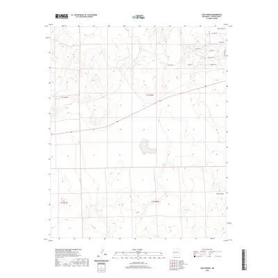
2020 Map of Cow Springs
USGS Topo · Published 2020About this map
Cow Springs and the ephemeral waters of Chihuahua Lake define this high-altitude corner of Catron County, New Mexico. The landscape is characterized by its drainage patterns, with Mayes Wash and Red Hill Draw cutting through the terrain. A sparse network of local roads and trails, including Old Ranch Rd and Cimarron Rd, provides access to the interior, reflecting a contemporary ranching or rural residential structure. The presence of Cowboy Pass suggests a primary route through the local topography, while newer naming conventions such as Dove Valley Rd and Wildflower Dr in the northeastern quadrant point toward more recent developments or subdivisions in this arid environment.
Find a feature on this map
16 named features on this map. Tap any name to fly to it.
Don’t see what you’re looking for? This feature index may not catch every label — zoom into the map to look around manually.
Map Details
Editions of this 2020 Cow Springs Map
This is the sole edition of this map. No revisions or reprints were ever made.
Other maps of this area

1886 · St Johns
USGS Topo · 1:250,000

1892 · St Johns
USGS Topo · 1:250,000

1954 · Saint Johns
USGS Topo · 1:250,000

1955 · Red Hill
USGS Topo · 1:24,000

1957 · Saint Johns
USGS Topo · 1:250,000

1958 · Saint Johns
USGS Topo · 1:250,000

1962 · Saint Johns
USGS Topo · 1:250,000
1968 · Nelson Reservoir NE
USGS Topo · 1:24,000
1968 · Loco Knoll
USGS Topo · 1:24,000
1971 · The Rincon
USGS Topo · 1:24,000