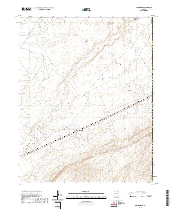
2021 Map of Cow Springs
USGS Topo · Published 2021About this map
Cow Springs serves as a central landmark in this high-desert region of Coconino County, where the elevation rises significantly from the wide floor of the Klethla Valley toward the expansive Shonto Plateau. Modern transportation routes like Navajo Trl and Indian Rte 16 traverse a landscape defined by deep drainages and volcanic or sandstone formations. Water sources, often intermittent in this environment, are critical markers for the area, including Reed Spring and Maitoh, while larger geographic features such as Shato Canyon and Begashibito Wash shape the northern and western drainage patterns. The map also records localized features like Wild Man Mesa and Porcupine Wash, illustrating the complex topography where the plateau transitions into broken mesas and valley floors.
Find a feature on this map
21 named features on this map. Tap any name to fly to it.
Don’t see what you’re looking for? This feature index may not catch every label — zoom into the map to look around manually.
Map Details
Editions of this 2021 Cow Springs Map
This is the sole edition of this map. No revisions or reprints were ever made.
Other maps of this area

1883 · Marsh Pass
USGS Topo · 1:250,000

1892 · Marsh Pass
USGS Topo · 1:250,000

1956 · Marble Canyon
USGS Topo · 1:250,000

1959 · Marble Canyon
USGS Topo · 1:250,000

1961 · Marble Canyon
USGS Topo · 1:250,000

1970 · Cow Springs
USGS Topo · 1:24,000
1970 · Kydestea Spring
USGS Topo · 1:24,000

1970 · Square Butte
USGS Topo · 1:24,000

1970 · Black Mesa Wash NW
USGS Topo · 1:24,000

1970 · Whirlwind Rock
USGS Topo · 1:24,000