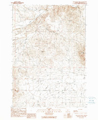
1990 Map of Cow Valley West
USGS Topo · Published 1990About this map
Bonita stands as a primary point of reference in this high-desert landscape of eastern Oregon during the late twentieth century. The terrain is defined by the broad expanse of Cow Valley, a geographic basin framed by prominent volcanic features such as Worsham Butte, Saddle Butte, and Cow Valley Butte. A complex network of intermittent watercourses, including Cow Creek, Lyman Creek, and Blue Creek, drains toward the valley floor, illustrating the hydraulic patterns of this arid Malheur County environment.
Find a feature on this map
21 named features on this map. Tap any name to fly to it.
Don’t see what you’re looking for? This feature index may not catch every label — zoom into the map to look around manually.
Map Details
Editions of this 1990 Cow Valley West Map
This is the sole edition of this map. No revisions or reprints were ever made.
Other maps of this area

1955 · Baker
USGS Topo · 1:250,000

1959 · Baker
USGS Topo · 1:250,000

1964 · Bridgeport
USGS Topo · 1:62,500

1964 · Brogan
USGS Topo · 1:62,500

1964 · Ironside
USGS Topo · 1:62,500

1966 · Clover Creek Ranch
USGS Topo · 1:62,500

1980 · Brogan
USGS Topo · 1:100,000
1990 · Brady Creek
USGS Topo · 1:24,000
1990 · Ironside
USGS Topo · 1:24,000
1990 · Scratch Post Butte
USGS Topo · 1:24,000