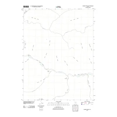
2011 Map of Cowboy Bench
USGS Topo · Published 2011About this map
Nine Mile Canyon dominates this 2011 survey, following the winding path of Nine Mile Creek through Duchesne County. This area is a critical corridor of natural resource extraction and high-desert geography, as evidenced by the Nine Mile Gas Field located near the intersection of Prickly Pear Rd and 9 Mile Canyon Rd. The landscape is characterized by its dramatic verticality, from the towering Bad Land Cliffs in the north to distinctive formations like The Mummy and The Alcove.
Find a feature on this map
26 named features on this map. Tap any name to fly to it.
Don’t see what you’re looking for? This feature index may not catch every label — zoom into the map to look around manually.
Map Details
Editions of this 2011 Cowboy Bench Map
This is the sole edition of this map. No revisions or reprints were ever made.
Other maps of this area

1886 · Price River
USGS Topo · 1:250,000

1896 · Price River
USGS Topo · 1:250,000

1915 · Sunnyside
USGS Topo · 1:62,500

1954 · Flat Canyon
USGS Topo · 1:62,500

1956 · Price
USGS Topo · 1:250,000

1960 · Price
USGS Topo · 1:250,000

1962 · Price
USGS Topo · 1:250,000
1965 · Wilkin Ridge
USGS Topo · 1:24,000
1968 · Anthro Mtn NE
USGS Topo · 1:24,000
1968 · Cowboy Bench
USGS Topo · 1:24,000