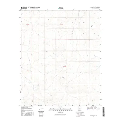
2017 Map of Cowboy Mesa
USGS Topo · Published 2017About this map
Cowboy Mesa rises as a central landform in this high-desert portion of Lincoln County, defined by a network of ephemeral watercourses and livestock infrastructure. The landscape is carved by significant drainage systems including Buck Draw and Corn Draw, which feed into larger arteries like the Gallo Arroyo. In this arid environment, the presence of named water catchments such as Buck Tank and Clarence Tank points to the area's ongoing importance for ranching and land management. Transportation is limited to a sparse grid of rural routes, specifically Co RD 8020 and Co RD 8021, which cross the township and range boundaries of t2s r18e and t3s r18e. The survey details the fine-scale topography around Cola del Gallo Arroyo, illustrating the complex erosion patterns that characterize the New Mexican interior.
Find a feature on this map
13 named features on this map. Tap any name to fly to it.
Don’t see what you’re looking for? This feature index may not catch every label — zoom into the map to look around manually.
Map Details
Editions of this 2017 Cowboy Mesa Map
This is the sole edition of this map. No revisions or reprints were ever made.
Other maps of this area

1954 · Fort Sumner
USGS Topo · 1:250,000

1955 · Roswell
USGS Topo · 1:250,000

1958 · Fort Sumner
USGS Topo · 1:250,000

1958 · Roswell
USGS Topo · 1:250,000

1962 · Roswell
USGS Topo · 1:250,000

1967 · Chivata Canyon
USGS Topo · 1:24,000

1967 · Ramon
USGS Topo · 1:24,000

1967 · Ramon SW
USGS Topo · 1:24,000

1979 · Fort Sumner
USGS Topo · 1:100,000
1979 · Salt Creek
USGS Topo · 1:100,000