
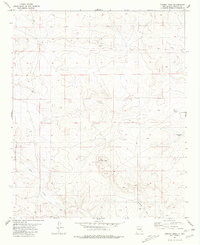
1981 Map of Cowboy Mesa NE
USGS Topo · Published 1981About this map
Cowboy Mesa defines this high-desert region of Lincoln County, where survival and settlement revolved around critical water infrastructure. Surveyed in the early 1970s and finalized in 1981, the landscape is marked by remote ranching landmarks such as Kuykendall Well, East Kuykendall Well, and High Well. The presence of a small Cem and several tanks suggests the presence of isolated family operations in a terrain punctuated by Gypsum outcroppings and modern utilities like a Radio Tower and an expansive Pipeline. This map captures a specific moment in the mid-century New Mexico backcountry before modern consolidation, preserving the locations of ephemeral water sources like Ditch Lake and numerous unnamed wells that served the livestock industry of the era.
Find a feature on this map
13 named features on this map. Tap any name to fly to it.
Don’t see what you’re looking for? This feature index may not catch every label — zoom into the map to look around manually.
Map Details
Editions of this 1981 Cowboy Mesa NE Map
This is the sole edition of this map. No revisions or reprints were ever made.
Other maps of this area

1954 · Fort Sumner
USGS Topo · 1:250,000

1958 · Fort Sumner
USGS Topo · 1:250,000

1967 · Ramon
USGS Topo · 1:24,000

1967 · Ramon SW
USGS Topo · 1:24,000

1979 · Fort Sumner
USGS Topo · 1:100,000

1980 · Corona
USGS Topo · 1:100,000

1981 · Loco Draw
USGS Topo · 1:24,000

1981 · Gacho Hill SW
USGS Topo · 1:24,000

1981 · Cowboy Mesa SW
USGS Topo · 1:24,000
1981 · Cowboy Mesa
USGS Topo · 1:24,000