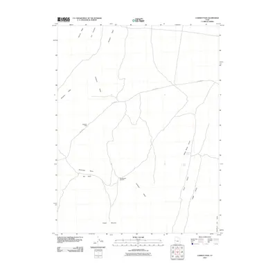
2010 Map of Cowboy Pass
USGS Topo · Published 2010About this map
Confusion Range terrain dominates this desert landscape, where high ridgelines and secluded springs define the remote interior of Millard County. The historic route of Old 6 and 50 winds through the topography, passing the eponymous Cowboy Pass and tracking north of Rattlesnake Bench. The map records essential water sources in an arid environment, notably Willow Spring and Skunk Spring, which likely served as critical stops for travelers and livestock long before modern surveying. Significant geological features such as Conger Mountain in the south and the sharp profile of Chevron Ridge to the north highlight the dramatic vertical relief of the Great Basin. This document captures the intricate drainage patterns of Red Gulch and the complex canyon systems including Willow Spring Canyon and Ledger Canyon, providing a precise look at the landforms as they existed in the early 21st century.
Find a feature on this map
16 named features on this map. Tap any name to fly to it.
Don’t see what you’re looking for? This feature index may not catch every label — zoom into the map to look around manually.
Map Details
Editions of this 2010 Cowboy Pass Map
This is the sole edition of this map. No revisions or reprints were ever made.
Other maps of this area

1908 · Fish Springs
USGS Topo · 1:250,000

1910 · Fish Springs
USGS Topo · 1:250,000

1953 · Delta
USGS Topo · 1:250,000

1958 · Delta
USGS Topo · 1:250,000

1959 · Cowboy Pass
USGS Topo · 1:62,500

1960 · Conger Range
USGS Topo · 1:62,500

1960 · Gandy
USGS Topo · 1:62,500

1960 · Conger Mountain
USGS Topo · 1:62,500

1962 · Delta
USGS Topo · 1:250,000
1981 · Tule Valley
USGS Topo · 1:100,000