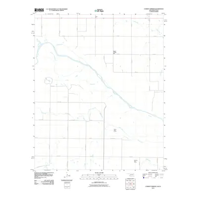
2010 Map of Cowboy Springs
USGS Topo · Published 2010About this map
The Red River meanders across this borderlands landscape, defining the geographic divide between Oklahoma and Texas. Agricultural infrastructure dominates the terrain, evidenced by industrial landmarks like Taylor Corner Gin and Valley Gin, which anchor the local cotton economy. The map reveals a highly structured grid of section roads, including County Line Rd, which facilitates movement between rural farmsteads and processing centers.
Find a feature on this map
36 named features on this map. Tap any name to fly to it.
Don’t see what you’re looking for? This feature index may not catch every label — zoom into the map to look around manually.
Map Details
Editions of this 2010 Cowboy Springs Map
This is the sole edition of this map. No revisions or reprints were ever made.
Other maps of this area

1915 · Barwise School
USGS Topo · 1:24,000

1916 · Electra
USGS Topo · 1:24,000

1918 · Electra
USGS Topo · 1:31,680

1918 · Barwise School
USGS Topo · 1:31,680

1955 · Lawton
USGS Topo · 1:250,000

1958 · Davidson
USGS Topo · 1:62,500

1958 · Frederick
USGS Topo · 1:62,500

1958 · Electra
USGS Topo · 1:62,500
1972 · Electra
USGS Topo · 1:24,000
1972 · Sunshine Hill
USGS Topo · 1:24,000