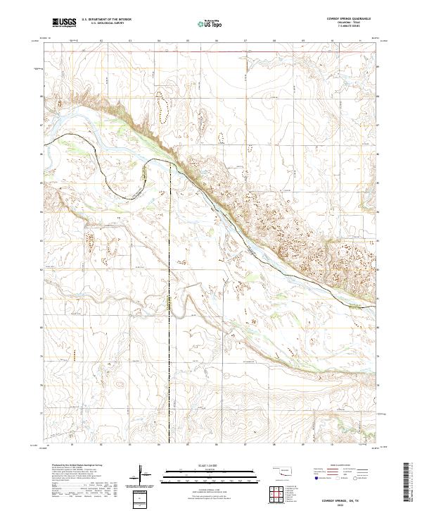
2022 Map of Cowboy Springs
USGS Topo · Published 2022About this map
The Red River defines this landscape, carving a wide, shifting path that serves as the jurisdictional border between Oklahoma and Texas. This survey captures the intricate braided channels and sandbars characteristic of the river valley, where Tillman County, Oklahoma, meets Wilbarger and Wichita counties in Texas. Inland from the river's edge, the terrain is shaped by several drainages, including Cowboy Springs, Adams Cr, and Cooper Cr. The rural infrastructure is marked by a deliberate grid of township and range lines, such as t4s r17w and t5s r16w, which guide the network of local roads. While largely agricultural and open, the map reveals specific local corridors like Mt Carmel Rd and Enterprise Rd that connect dispersed homesteads to the wider region. For those studying the evolution of the Red River boundary or family roots in these borderlands, the map provides a precise look at the land as it was organized in 2022.
Find a feature on this map
42 named features on this map. Tap any name to fly to it.
Don’t see what you’re looking for? This feature index may not catch every label — zoom into the map to look around manually.
Map Details
Editions of this 2022 Cowboy Springs Map
This is the sole edition of this map. No revisions or reprints were ever made.
Other maps of this area

1915 · Barwise School
USGS Topo · 1:24,000

1916 · Electra
USGS Topo · 1:24,000

1918 · Electra
USGS Topo · 1:31,680

1918 · Barwise School
USGS Topo · 1:31,680

1955 · Lawton
USGS Topo · 1:250,000

1958 · Davidson
USGS Topo · 1:62,500

1958 · Frederick
USGS Topo · 1:62,500

1958 · Electra
USGS Topo · 1:62,500
1972 · Electra
USGS Topo · 1:24,000
1972 · Sunshine Hill
USGS Topo · 1:24,000