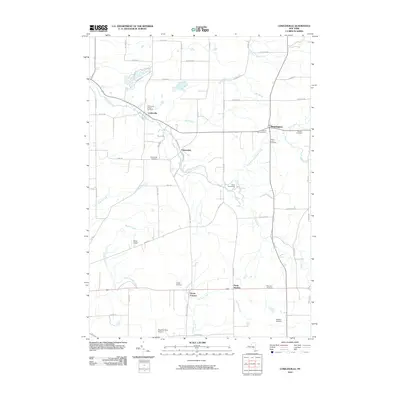
2010 Map of Cowlesville
USGS Topo · Published 2010About this map
Cowlesville and the surrounding rural hamlets of Wyoming and Erie counties appear here in a landscape defined by the branching tributaries of Cayuga Creek. This 2010 survey records the enduring settlement patterns of Western New York, where small crossroads communities like Folsomdale and Bennington remain anchored by several local burial grounds, including the Cowlesville Village Cemetery and Sacred Heart Cemetery. The terrain is marked by a network of drainage systems such as Little Buffalo Creek, Stony Bottom Creek, and French Brook, which carve through the farmland between established roads like Folsomdale Rd and Sullivan Rd.
Find a feature on this map
62 named features on this map. Tap any name to fly to it.
Don’t see what you’re looking for? This feature index may not catch every label — zoom into the map to look around manually.
Map Details
Editions of this 2010 Cowlesville Map
This is the sole edition of this map. No revisions or reprints were ever made.
Other maps of this area

1905 · Attica
USGS Topo · 1:62,500

1905 · Depew
USGS Topo · 1:62,500

1923 · Arcade
USGS Topo · 1:62,500

1925 · Springville
USGS Topo · 1:62,500

1925 · Arcade
USGS Topo · 1:62,500

1944 · Alexander
USGS Topo · 1:31,680

1948 · Depew
USGS Topo · 1:62,500

1949 · Attica
USGS Topo · 1:62,500

1949 · Alexander
USGS Topo · 1:24,000

1949 · Cowlesville
USGS Topo · 1:24,000