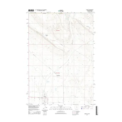
2015 Map of Cowley
USGS Topo · Published 2015About this map
Cowley serves as the primary settlement on this Big Horn County landscape, organized along a strict grid featuring W Main St, E Main St, and N Division St. The surrounding geography is defined by a complex irrigation and water management network, essential for high-desert agriculture, including Lateral D-56, Jensons Pond, and the Peterson Cr drainage. To the north, the terrain transitions into the distinct topography of Petroglyph Canyon and the drainage of Gypsum Cr.
Find a feature on this map
36 named features on this map. Tap any name to fly to it.
Don’t see what you’re looking for? This feature index may not catch every label — zoom into the map to look around manually.
Map Details
Editions of this 2015 Cowley Map
This is the sole edition of this map. No revisions or reprints were ever made.
Other maps of this area

1954 · Billings
USGS Topo · 1:250,000

1955 · Cody
USGS Topo · 1:250,000

1957 · Billings
USGS Topo · 1:250,000

1958 · Billings
USGS Topo · 1:250,000

1958 · Cody
USGS Topo · 1:250,000

1962 · Cody
USGS Topo · 1:250,000

1964 · Red Pryor Mountain
USGS Topo · 1:24,000

1964 · Lovell Lakes
USGS Topo · 1:24,000

1964 · Sykes Spring
USGS Topo · 1:24,000
1964 · Mystery Cave
USGS Topo · 1:24,000