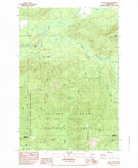
1983 Map of Cowlitz Falls
USGS Topo · Published 1984About this map
Cowlitz River and the Cispus River converge in this high-elevation landscape of the Pacific Northwest, captured shortly after the 1980 eruption of Mount St. Helens. The terrain is defined by the Gifford Pinchot National Forest and the Mount St Helens National Volcanic Monument, featuring steep elevations like Huffaker Mountain and Strawberry Mountain. Cultural markings are sparse but significant, including the Kelly Ranch and a remote Landing Strip near the riverbanks. Of particular interest is the area around Cowlitz Falls, which the map notes is Subject to Inundation 779, indicating the planned hydrological changes for the region. Numerous drainage features such as Tumwater Creek, Quartz Creek, and Crystal Creek carve through the timbered slopes, while old 4wd tracks and a Pack Trail provide the primary means of access to the high backcountry.
Find a feature on this map
27 named features on this map. Tap any name to fly to it.
Don’t see what you’re looking for? This feature index may not catch every label — zoom into the map to look around manually.
Map Details
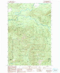
Editions of this 1983 Cowlitz Falls Map
2 editions found
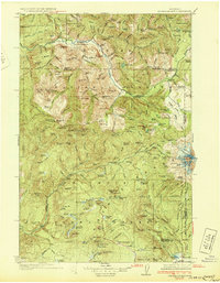
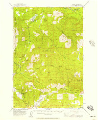
Other maps of this area

1919 · Mount St Helens
USGS Topo · 1:125,000

1924 · Mt Rainier
USGS Topo · 1:96,000

1926 · Steamboat Mtn
USGS Topo · 1:125,000

1928 · Mt Rainier
USGS Topo · 1:125,000
1931 · Steamboat Mtn
USGS Topo · 1:125,000

1937 · Eatonville
USGS Topo · 1:125,000

1950 · Yakima
USGS Topo · 1:250,000

1953 · Hoquiam
USGS Topo · 1:250,000
1956 · Mineral
USGS Topo · 1:62,500

1957 · Hoquiam
USGS Topo · 1:250,000