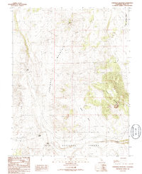
1986 Map of Cowtrack Mountain
USGS Topo · Published 1986About this map
Inyo National Forest dominates this high-altitude landscape in Mono County, where water is the primary driver of name and activity. The terrain is defined by the massive ridge of Cowtrack Mountain and the high elevation of Granite Mountain, separated by the lower Granite Basin. Despite the elevation, the map identifies several critical water sources, including Cowtrack Spring, Indian Spring, and Gaspipe Spring, which likely served as vital stopovers for travelers and early surveyors moving through the eastern Sierra. Occasional Prospect labels suggest small-scale mineral exploration, while North Canyon provides a natural corridor through the northern sections of this mountainous region. The land remains largely undeveloped, preserving the original surveying lines and natural features of the mid-1980s.
Find a feature on this map
12 named features on this map. Tap any name to fly to it.
Don’t see what you’re looking for? This feature index may not catch every label — zoom into the map to look around manually.
Map Details
Editions of this 1986 Cowtrack Mountain Map
This is the sole edition of this map. No revisions or reprints were ever made.
Other maps of this area

1909 · Hawthorne
USGS Topo · 1:250,000

1911 · Hawthorne
USGS Topo · 1:250,000

1914 · Mt. Morrison
USGS Topo · 1:125,000

1915 · Hawthorne
USGS Topo · 1:250,000

1947 · Mariposa
USGS Topo · 1:250,000

1948 · Walker Lake
USGS Topo · 1:250,000

1948 · Mariposa
USGS Topo · 1:250,000

1957 · Walker Lake
USGS Topo · 1:250,000

1957 · Mariposa
USGS Topo · 1:250,000

1958 · Trench Canyon
USGS Topo · 1:62,500