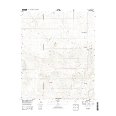
2013 Map of Cox Peak
USGS Topo · Published 2013About this map
Cox Peak serves as the topographic anchor for this expanse of the Cibola National Forest in western New Mexico. The landscape is defined by an intricate network of ephemeral water drainage and collection, dominated by the winding paths of Pino Draw, Nester Draw, and Flying V Draw. This 2013 survey illustrates how water management is critical to this high-desert environment, evidenced by the numerous catchment points such as Armijo Tank, North Boundary Tank, and the appropriately named Last Chance Tank.
Find a feature on this map
21 named features on this map. Tap any name to fly to it.
Don’t see what you’re looking for? This feature index may not catch every label — zoom into the map to look around manually.
Map Details
Editions of this 2013 Cox Peak Map
This is the sole edition of this map. No revisions or reprints were ever made.
Other maps of this area

1954 · Saint Johns
USGS Topo · 1:250,000

1954 · Socorro
USGS Topo · 1:250,000

1957 · Saint Johns
USGS Topo · 1:250,000

1958 · Socorro
USGS Topo · 1:250,000

1958 · Saint Johns
USGS Topo · 1:250,000

1962 · Socorro
USGS Topo · 1:250,000

1962 · Saint Johns
USGS Topo · 1:250,000
1964 · Madre Mountain
USGS Topo · 1:24,000

1964 · Crosby Springs
USGS Topo · 1:24,000
1965 · Sugarloaf Mountain
USGS Topo · 1:24,000