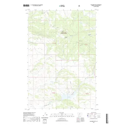
2020 Map of Coxcombe Butte
USGS Topo · Published 2020About this map
Lewis & Clark National Forest encompasses much of this landscape, where the Little Belt Mountains meet the high plains. The topography is defined by prominent elevations such as Coxcombe Butte and Abbott Ridge, which overlook a network of seasonal and perennial drainages. Significant water management features include Buckingham Reservoir and the Newlan Creek Reservoir, which capture runoff from the surrounding slopes. The area is intersected by a complex system of gulches, including Decker Gulch and Thornquist Gulch, alongside numerous water sources like Buffalo Spring and Horsefly Spring. Transport in this part of Meagher County is facilitated by routes such as Newlan Creek Rd and the Newlan Trl, providing access through the Park Hills and across various forks of Whitetail Deer Cr. This map illustrates the vital role of high-altitude water sources in supporting the regional hydrology.
Find a feature on this map
29 named features on this map. Tap any name to fly to it.
Don’t see what you’re looking for? This feature index may not catch every label — zoom into the map to look around manually.
Map Details
Editions of this 2020 Coxcombe Butte Map
This is the sole edition of this map. No revisions or reprints were ever made.
Other maps of this area

1886 · Fort Logan
USGS Topo · 1:250,000

1886 · Little Belt Mts.
USGS Topo · 1:250,000

1894 · Little Belt Mts.
USGS Topo · 1:250,000

1897 · Little Belt Mts.
USGS Topo · 1:250,000

1898 · Little Belt Mts.
USGS Topo · 1:250,000

1902 · Little Belt Mts.
USGS Topo · 1:250,000

1948 · White Sulphur Springs
USGS Topo · 1:250,000

1958 · White Sulphur Springs
USGS Topo · 1:250,000

1961 · White Sulphur Springs
USGS Topo · 1:250,000

1965 · White Sulphur Springs
USGS Topo · 1:250,000