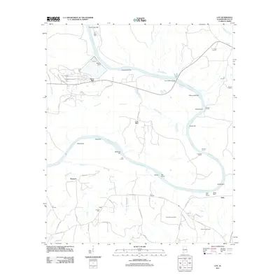
2011 Map of Coy
USGS Topo · Published 2011About this map
The Alabama River carves a massive, serpentine path through this Wilcox County landscape, defining the region's geography with its expansive sandbars and bluffs. Settlement patterns here are tied closely to the river's bends, as seen in the locations of Yellow Bluff and the small community of Nellie. The transition from river-based transport to modern infrastructure is evident in the numerous historical points along the banks, such as Beauford Landing, Coal Bluff Landing, and the Ead Ferry Landing, now bypassed by the Frank Dobson Bridge.
Find a feature on this map
62 named features on this map. Tap any name to fly to it.
Don’t see what you’re looking for? This feature index may not catch every label — zoom into the map to look around manually.
Map Details
Editions of this 2011 Coy Map
This is the sole edition of this map. No revisions or reprints were ever made.
Other maps of this area

1953 · Montgomery
USGS Topo · 1:250,000

1953 · Andalusia
USGS Topo · 1:250,000

1956 · Montgomery
USGS Topo · 1:250,000

1957 · Montgomery
USGS Topo · 1:250,000

1957 · Andalusia
USGS Topo · 1:250,000

1973 · Coy
USGS Topo · 1:24,000

1973 · Hybart
USGS Topo · 1:24,000

1973 · Pine Hill
USGS Topo · 1:24,000

1973 · Camden South
USGS Topo · 1:24,000

1973 · Lower Peach Tree
USGS Topo · 1:24,000