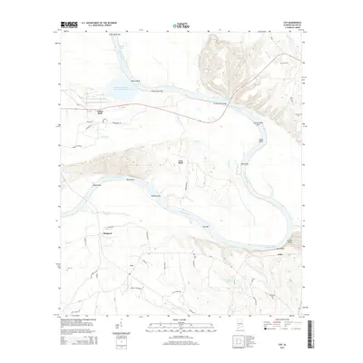
2014 Map of Coy
USGS Topo · Published 2014About this map
The Alabama River carves a massive, serpentine path through Wilcox County, defining the geography of this central Alabama landscape. Numerous fluvial features such as Yellow Jacket Bar, Wilcox Bar, and Matthews Bar indicate the river's active sediment transport and shifting nature within its flood plain. Small communities like Yellow Bluff and Coy are connected by a network of rural roads, including CR-12 and Tates Chapel Rd, while the Frank Dobson Bridge provides a vital crossing over the main channel near Lake Glen.
Find a feature on this map
56 named features on this map. Tap any name to fly to it.
Don’t see what you’re looking for? This feature index may not catch every label — zoom into the map to look around manually.
Map Details
Editions of this 2014 Coy Map
This is the sole edition of this map. No revisions or reprints were ever made.
Other maps of this area

1953 · Montgomery
USGS Topo · 1:250,000

1953 · Andalusia
USGS Topo · 1:250,000

1956 · Montgomery
USGS Topo · 1:250,000

1957 · Montgomery
USGS Topo · 1:250,000

1957 · Andalusia
USGS Topo · 1:250,000

1973 · Coy
USGS Topo · 1:24,000

1973 · Hybart
USGS Topo · 1:24,000

1973 · Pine Hill
USGS Topo · 1:24,000

1973 · Camden South
USGS Topo · 1:24,000

1973 · Lower Peach Tree
USGS Topo · 1:24,000