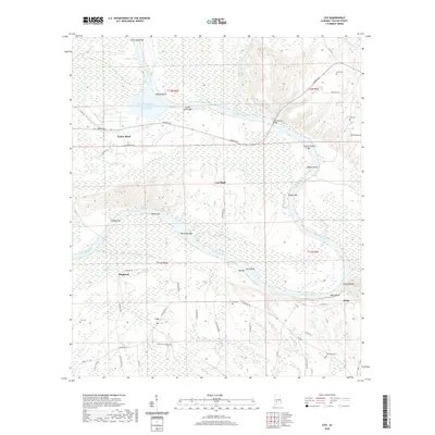
2020 Map of Coy
USGS Topo · Published 2020About this map
Yellow Bluff and the surrounding rural landscape of Wilcox County are defined by the winding course of the Alabama River as it creates a series of sandbars and islands. This contemporary survey documents the river’s reach from Evans Upper Bar down to Gullett Bluff, showing a landscape where heavy industry and natural features coexist. The presence of the MacMillan Bloedel Incorporated Waste Pond near the riverbank highlights the region’s industrial history, while landmarks like Coal Bluff and Yellow Jacket Bar speak to the river's geologic and navigational character. South of the river, small settlements such as Coy, Sheppard, and Nellie are connected by a network of local roads including J M Brooks Rd and McMillan Rd. For genealogists, the map preserves the locations of family-named sites like Tait Cem, Cook Cem, and McPherson Cem, offering a detailed view of the community's ancestral footprint in the Alabama Black Belt.
Find a feature on this map
57 named features on this map. Tap any name to fly to it.
Don’t see what you’re looking for? This feature index may not catch every label — zoom into the map to look around manually.
Map Details
Editions of this 2020 Coy Map
This is the sole edition of this map. No revisions or reprints were ever made.
Other maps of this area

1953 · Montgomery
USGS Topo · 1:250,000

1953 · Andalusia
USGS Topo · 1:250,000

1956 · Montgomery
USGS Topo · 1:250,000

1957 · Montgomery
USGS Topo · 1:250,000

1957 · Andalusia
USGS Topo · 1:250,000

1973 · Coy
USGS Topo · 1:24,000

1973 · Hybart
USGS Topo · 1:24,000

1973 · Pine Hill
USGS Topo · 1:24,000

1973 · Camden South
USGS Topo · 1:24,000

1973 · Lower Peach Tree
USGS Topo · 1:24,000