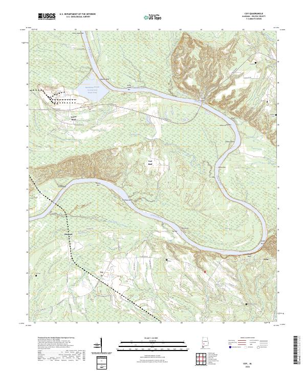
2024 Map of Coy
USGS Topo · Published 2024About this map
Alabama River curves deeply through this Wilcox County landscape, defining the geography between Coy and Nellie. The river is marked by numerous bars and bluffs, including Coal Bluff and Yellow Bluff, which reflect the region's geological and navigational history. An industrial presence is noted at MacMillan Bloedel Incorporated, featuring an associated Waste Pond near Walnut Bluff. For those researching family history, several small burial grounds are scattered throughout the hills, such as Cook Cem, Tait Cem, and McPherson Cem. The local transportation network relies on rural connectors like Jim Brooks Rd and Camden Byp, while the Holly Ferry label indicates a historical crossing point near Lake Glen. This area maintains a predominantly rural character, characterized by the winding river and the creeks that feed into it, including Black Creek and Dunns Creek.
Find a feature on this map
58 named features on this map. Tap any name to fly to it.
Don’t see what you’re looking for? This feature index may not catch every label — zoom into the map to look around manually.
Map Details
Editions of this 2024 Coy Map
This is the sole edition of this map. No revisions or reprints were ever made.
Other maps of this area

1953 · Montgomery
USGS Topo · 1:250,000

1953 · Andalusia
USGS Topo · 1:250,000

1956 · Montgomery
USGS Topo · 1:250,000

1957 · Montgomery
USGS Topo · 1:250,000

1957 · Andalusia
USGS Topo · 1:250,000

1973 · Coy
USGS Topo · 1:24,000

1973 · Hybart
USGS Topo · 1:24,000

1973 · Pine Hill
USGS Topo · 1:24,000

1973 · Camden South
USGS Topo · 1:24,000

1973 · Lower Peach Tree
USGS Topo · 1:24,000