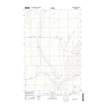
2013 Map of Coyote Butte
USGS Topo · Published 2013About this map
Cow Creek winds through the volcanic Coulee landscape of central Washington, defining the drainage patterns south of Thavis. This high-desert plateau is marked by distinct topographic rises like Terksaleeze Butte and Coyote Butte, which provided natural landmarks for the early transit routes through Adams County. The mapping shows a network of rural corridors, including the storied Old Military Rd, which historically linked inland forts and settlements. Near the southern edge of the survey, the small community of Mack sits along Mack Rd, while the isolated Spider Lake occupies a low-lying depression to the east. The section lines of the Public Land Survey System, including t17n r36e and t16n r37e, create a rigid grid across the undulating terrain, illustrating the systematic division of land for agricultural and grazing use in the early twenty-first century.
Find a feature on this map
16 named features on this map. Tap any name to fly to it.
Don’t see what you’re looking for? This feature index may not catch every label — zoom into the map to look around manually.
Map Details
Editions of this 2013 Coyote Butte Map
This is the sole edition of this map. No revisions or reprints were ever made.
Other maps of this area

1923 · Washtucna
USGS Topo · 1:62,500

1925 · Washtucna
USGS Topo · 1:62,500

1950 · Benge
USGS Topo · 1:62,500

1952 · Benge
USGS Topo · 1:62,500

1953 · Walla Walla
USGS Topo · 1:250,000

1953 · Ritzville
USGS Topo · 1:250,000

1958 · Walla Walla
USGS Topo · 1:250,000

1959 · Ritzville
USGS Topo · 1:250,000

1964 · Macall
USGS Topo · 1:24,000

1964 · Marengo
USGS Topo · 1:24,000